About
The soil science group at UNSW is involved with and interested in the use of ancillary data from remote and proximal soil sensors and their application to digital soil mapping. The group has at its disposal and regular uses remote and proximal sensed gamma-ray spectrometry data (i.e. Radiation Solutions RS240 and RS700) as well as proximal sensed electromagnetic (EM) induction instruments (i.e. Geonics EM31, EM34 and a DUALEM-421).
The group publishes research in the areas of digital soil mapping of soil properties (e.g. clay, salinity and CEC) as well as identifying soil management zones or soil types. The research is undertaken mostly at the field scale but also using data sets acquired at multiple farms and districts scales. In recent investigations, research has been carried out with scientists in England (British Geological Survey), Portugal (Universidade de Lisboa), Spain (IFAPA), Morocco (INRA) and USA (USDA-ARS). In Australia, research has been undertaken in NSW (University of Sydney), Nth Queensland (HCPSL) and Western Australia (Department of Agriculture, Food and Forestry).
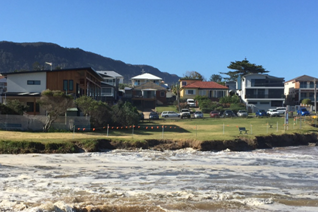
Over the last five years, the group has been pioneering the area of developing 2-d, 3-d and 4-d electromagnetic conductivity imaging (EMCI) capabilities using a DUALEM-421 and EM4Soil software. Applications have included the development of EMCI to assess soil salinity and freshwater plumes emanating from beneath a large earthen water storage and 2-d time lapse imaging of water and forecasting beneath irrigated legume crops. 4-d imaging has also been shown to be possible and to understand the dynamics of beachface salinity.
People
The group is led by Dr John Triantafilis with many fabulously friendly and "hardly" working postgraduate students, including:
- Mr Jingyi Huang who is currently working on completing his PhD thesis (Mapping and monitoring soil water dynamics using electromagnetic conductivity imaging)
- Mr Ehsan Zare, who is currently working on completing his MPhil thesis (Digital soil mapping of landscape units and salinity across the Bourke Irrigation District)
- Mr Muddassar Muzzamil, who is currently undertaking an MPhil thesis (Digital soil mapping of particle size fractions and soil management zones at the field scale)
- Mr Triven Koganti, who is currently undertaking an MPhil thesis (Using geophysical methods to map landfill leachate plumes).

