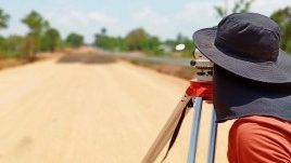
The Surveying and Geospatial Engineering (SAGE) Research Group has been a leader in world-class research in remote sensing, geodesy, GIS, multi-GNSS and multi-sensor positioning. Through close links with industry and Government bodies, our researchers have access to state-of-the-art facilities both on and off campus.
The quality and impact of our research is indicated by our outstanding numbers of publications, PhD and Masters theses completed, technological achievements and prizes won by graduate students.
Research themes
Our team of experts are focused on research in:
Remote sensing
- Radar remote sensing
- UAV and airborne photogrammetry
- Applications in natural disaster monitoring, dryland ecology and geological engineering
- High-resolution optical/ infrared imaging systems
- Persistent scatterer radar interferometry
- Near-real-time satellite remote sensing
- Sensor calibration
- Direct georeferencing of sensors and automated feature extraction
- Enhanced feature extraction from multi-layered datasets
- Deep learning from multispectral/hyperspectral images and data fusion with lidar point clouds
Geodetic infrastructure and analysis
Our researchers have advanced datum modernisation for national and international scale reference frames such as the International Terrestrial Reference Frame (ITRF). They are developing schema for complex time-dependent transformation between geodetic reference frames. We lend our expertise and review policy implications of new measurement technologies applied to authoritative geospatial data management (GNSS for cadastral, DCDB, LandXML, eGeodesy, SUI standards).
Light detection and ranging (Lidar)
- Laser scanning using Lidar systems typically mounted on aircraft or road vehicles used for civil engineering applications with high spatial resolution and accuracy
- Sophisticated analysis of lidar sensor data, applications-specific algorithms for terrain and forest mapping
- 3D city modelling and rapid mobile mapping of transport corridors and engineering structures.
- Spatial information extraction from lidar data, UAV imagery and aerial/satellite imagery for data segmentation and classification, digital elevation modelling, feature extraction, building edge detection, change detection and monitoring environmental changes
Geographic information system (GIS)
Our experts apply GIS to real-world problems enabling decision-making in asset/utility management, natural resources exploration, intelligent transportation, natural disaster/ emergency management and public health research.
We analyse spatial and temporal fire occurrence patterns using landscape attributes such as climate, terrain, land use to infer wildfire occurrence across Australia
We also apply this to develop effective flood emergency plans and response (shelter assignment and routing) and risk analysis to flag epidemics for urgent intervention.
Multi-GNSS
- Global Navigation Satellite Systems – GNSS (GPS, Glonass, Galileo, Beidou, QZSS, IRNSS) and their integration and augmentation with evolving CORS, PPP and SBAS systems both commercial and government supported
- Applications of multi-GNSS for static and kinematic positioning modes applied to modern geodetic control, cadastral and engineering surveying, topographic mapping, photogrammetry and national/ international geospatial reference frames
Multi-sensor integration for positioning, mapping
- Optimal integration of sensors such as, GNSS, INS, imaging/vision, laser, pseudolites (PLs) magnetometers, 3D digital maps
- Internet of things for terrestrial and airborne mobile mapping systems applied to precision farming, mining, construction, transport, environmental, geotechnical and structural monitoring
Statistical theory applied to positioning, mapping
- Mathematical, stochastic and robust modelling design
- Advanced optimal estimation theory
- Statistical quality control
- Fault detection and identification
- Reliability theory
- Integrity monitoring
- Statistical and geometric characteristics inherent within various sensors
- Least Square analysis and alternate analysis (L1 norm, grid searching) of surveying measurements
For a more in-depth description of our research themes, view our Research Topics.
Surveying textbook
Our SAGE academic contributes to many textbooks. Download the Survey Computations textbook by Dr Bruce Harvey


