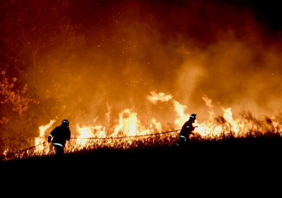
Climate change will make fire storms more likely in southeastern Australia
Extreme fire risk will overlap with weather patterns to create fire tornadoes more often under climate change.
Extreme fire risk will overlap with weather patterns to create fire tornadoes more often under climate change.

Temperatures across many regions of Australia are set to exceed 40℃ this week, including heatwaves forecast throughout parts of eastern Australia, raising the spectre of more devastating bushfires.
We have already heard warnings this fire season of the possibility of firestorms, created when extreme fires in the right conditions form their own weather systems.
Firestorms are the common term for pyrocumulonimbus bushfires – fires so intense they create their own thunderstorms, extreme winds, black hail, and lightning.
While they are very rare, our research published earlier this year, found climate change is making it likely they will become more common in parts of southeast Australia.
We also identified certain regions in southern and eastern Australia, including near Melbourne’s fringe, that in the second half of this century will be far more vulnerable to these events than others.
The 2003 Canberra bushfires, devastating on a grand scale, saw a Canberra resident film a fire tornado for the first time ever. Six years later, the ferocious Black Saturday bushfires in Victoria created three separate pyrocumulonimbus events.
More recently, fire storms devastated California in November 2018.
Pyrocumulonimbus events begin with the intense heat of a very big and fast-burning wildfire, which causes a large and rapidly rising smoke plume. As the plume rises, low atmospheric pressure causes it to expand and cool. Moisture can condense into a type of cloud known as a pyrocumulus - not pyrocumulonimbus, yet. This type of cloud can be common in large fires.
However, with the right environmental conditions the plume goes much higher and pyrocumulonimbus clouds can form, towering up to 15km in some cases. As it rises, the plume cools, and the upper part of the clouds form ice particles that collide and can produce lightning.
These thunderstorms can create erratic and dangerously strong wind gusts. These can drive blizzards of embers that ignite spot fires beyond the fire font.
Lightning from the plume can start new fires, well ahead of the main fire. In one case, lightning generated in a pyrocumulonimbus cloud has been recorded starting new fires up to 100km ahead of the main fire.
One of the key elements to a firestorm forming is the precondition of the atmosphere above it. We wanted to investigate how a changing climate might affect the likelihood of firestorms happening.
Previous research has found there is more dynamic interaction between a large fire and the atmosphere when the air about 1.5km above the surface is relatively dry, and when there are larger temperature differences across increasing altitudes.
The larger the temperature difference, the more unstable the atmosphere may become. When higher altitudes get cold more quickly than normal, and are also very dry at low levels, it can become more likely that a pyrocumulonimbus event will develop during a large fire.
We used high-resolution climate modelling of projected lower atmospheric instability and dryness conditions to assess the risk of pyrocumulonimbus in southeastern Australia between 2060 and 2079, compared with 1990-2009. We then overlaid this information with the forest fire danger index to identify particularly dangerous fire days.
We were then able to identify how often dangerous fire weather days occurred at the same time as a dry and unstable atmosphere. Verifying our models against past observations, we then examined how often these two characteristics coincided in the future under climate change, should our greenhouse gas emissions remain on their current trajectory.
The results were startling. From 2060 onwards, we saw sharp increases in dangerous fire days across southeast Australia that coincided with atmospheric conditions primed to generate firestorms.
These extremely dangerous days also shifted across seasons, starting to appear in late spring, whereas historically Australian pyrocumulonimbus wildfires have typically been summer phenomena.
Across large areas of Victoria and South Australia, on average, we saw four or five more days every spring that were conducive to pyrocumulonimbus events.
These were sobering findings, even in a land of extremes like Australia. Our research suggests human-caused climate change has already resulted in more dangerous weather conditions for bushfires in recent decades for many regions of Australia. These trends are very likely to increase due to rising greenhouse gas emissions.
Giovanni Di Virgilio, Research associate, UNSW; Andrew Dowdy, Senior Research Scientist, Australian Bureau of Meteorology; Jason Evans, Associate Professor, UNSW; Jason Sharples, Associate Professor, School of Physical, Environmental and Mathematical Sciences, UNSW Australia, UNSW, and Rick McRae, Researcher, Bushfire Cooperative Research Centre, ACT Emergency Services Agency
This article is republished from The Conversation under a Creative Commons license. Read the original article.
![]()