Satellites and emergency response
Fire, smoke, dust storms and hail.
Published on the 24 Jan 2020

Fire, smoke, dust storms and hail.
Fire, smoke, dust storms and hail. It’s been a horror month for Australian weather, and while we’ve had people on the ground working hard to keep us safe and cleaning up the mess, one of their key tools is thousands of kilometres away in low-earth orbit.
As UNSW Canberra Space researcher Dr Chris Capon explains, satellites allow emergency services to predict the spread of fires, assess the risk areas and forecast air quality.
“Satellites provide the big picture perspective when mapping out and responding to natural disasters,” Dr Capon said.
“That perspective lets emergency services plan and prioritise how they respond and where they need to send their resources to help save lives.
“When you have an emergency scenario covering hundreds of thousands of hectares involving millions of people, understanding how to deploy limited resources most effectively, where flash points are, and forecast what’s coming next are essential.”
Fire Spread Prediction for Sat 4 Jan 2020
Dangerous fires in Shoalhaven, South Coast, Snowy Mountains & areas surrounding Greater Sydney. You should not be in potential spread areas or potential ember attack areas on Saturday. #nswrfs #nswfires pic.twitter.com/Ry14FXgPR2— NSW RFS (@NSWRFS) January 3, 2020
Dr Capon said that emergency services are provided with three broad types of satellite data:
The role of satellites doesn’t end after an emergency, Dr Capon said. They have an essential, ongoing role in helping clean up and rebuilding efforts after the disaster.
“They also help us plan for the future, to try and avoid and mitigate the scale of future disasters in the face of global climate change,” he said.
The majority of satellite data that we use for emergency response in Australia is provided by international organisations and groups that we pay for data. Dr Capon believes Australia could benefit from its own smart space infrastructure designed specifically for the country’s environment.

A NASA image of south-eastern Australia on 4 January 2020
“Imagine if we’d had a system setup able to identify a fire started by a lightning strike in real-time from space, provide an assessment on the threat level and speed of response required, and get that information right to the person with the right resources so that they can stop the fire before it gets out of control. That’s the sort of system that I believe we need to invest in for our future,” Dr Capon said.
Busy afternoon on the radar - storms in the NE and South, lee wave clouds in the SE caused by strong winds over the ranges, and dust entrained by the wind, can all be seen. Dust has now arrived in Sydney where it has reduced visibility. Forecast: https://t.co/IldugrBUKm pic.twitter.com/lfgzeDdUqe
— Bureau of Meteorology, New South Wales (@BOM_NSW) January 23, 2020
Combined with other pieces of data sourced closer to home, such as aerial mapping, satellites form an integral part of emergency management.
“Fusing different data sources, like crowdsourced emergency response data, with satellite imagery, weather forecasts, traffic logs, and putting it into forms that are useful for people to make decisions with is really important.”
Related stories:
UNSW Canberra Space collaborates with New Zealand scientists
UNSW Canberra collaborating on space communications
UNSW Canberra Space delves into the ionosphere
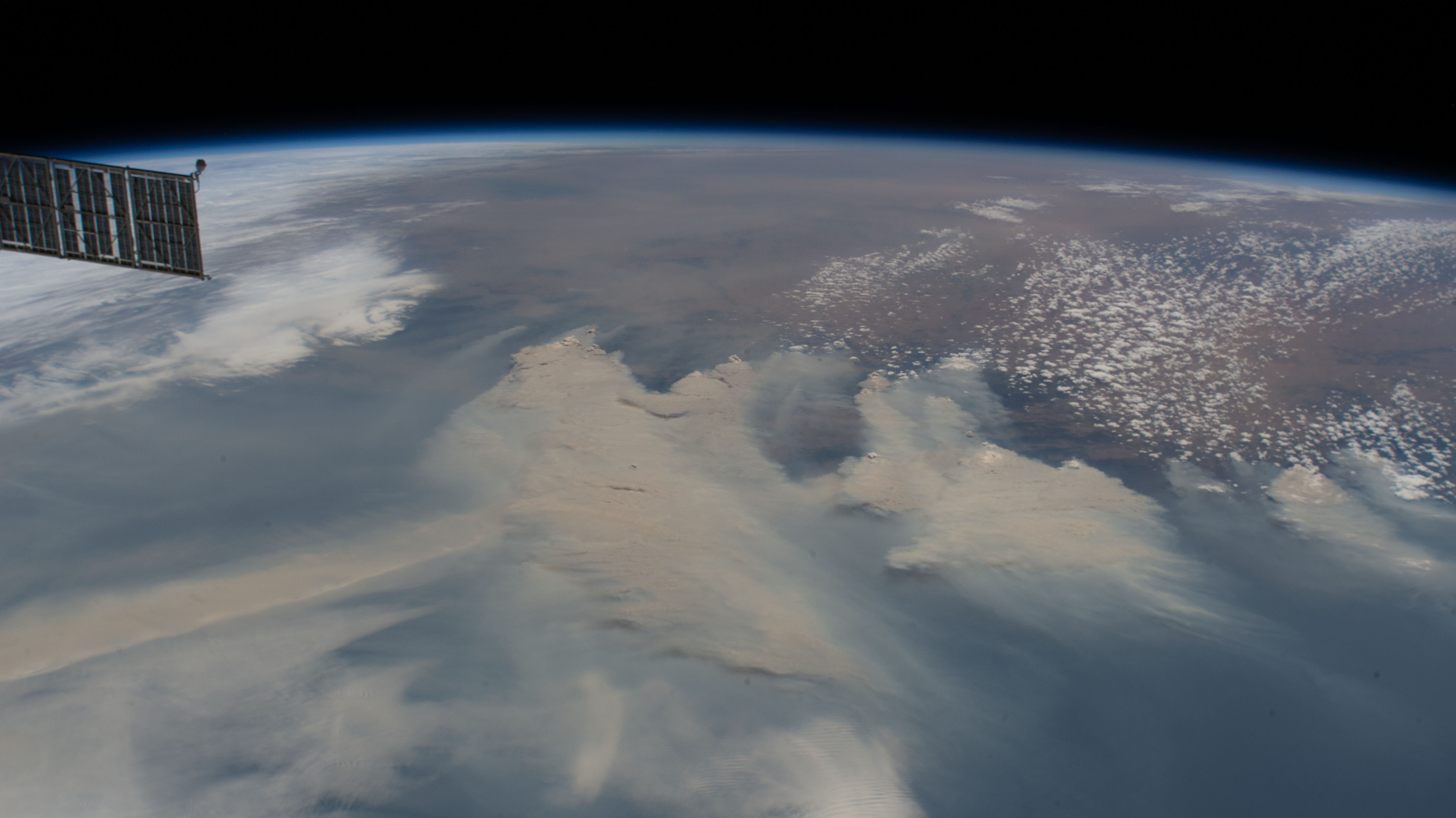
Main image: The International Space Station shows extreme fire activity on 4 January 2020 (NASA).
Visit the UNSW Canberra Future Students page for a range of space masters and PhD opportunities.