How 'Google Maps for buildings' can improve fire safety
A research team from UNSW Built Environment is using 3D mapping technology to help improve fire safety and crisis response procedures for Fire and Rescue NSW.
Published on the 21 Jan 2020

A research team from UNSW Built Environment is using 3D mapping technology to help improve fire safety and crisis response procedures for Fire and Rescue NSW.
The Geospatial Research Innovation Development (GRID) at UNSW Built Environment is taking maps into the third dimension to help accessibility, safety and emergency response procedures.
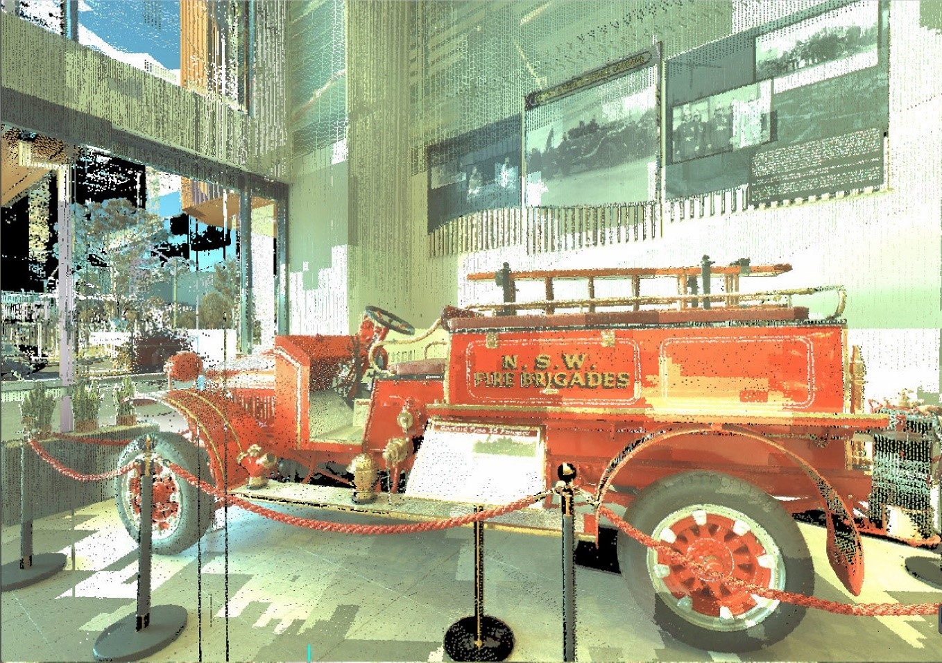
By processing point clouds – a set of data points in space – from a range of scanners in real-time, the team has created an interactive 3D model of the new Fire and Rescue NSW Emergency Services Academy building in Orchard Hills, Western Sydney with a range of safety-planning applications.
"Plans of buildings can be very different from their reality, [and they are] mostly two-dimensional, static or dated,” says Professor Sisi Zlatanova, who investigates the production and management of 3D digital models for large public buildings and urban spaces.
“They also don't contain accurate information as to what is inside the building, especially in the aftermath [of disasters], if there are blockages or hazards like hidden fire-spots, melted plastic and steel."
She says that having a three-dimensional map of the building's infrastructure can make the computing of navigation routes in disaster situations quick and flexible.
"It's the same as Google Maps, but for buildings and infrastructure," she says. "We were able to create a 3D model and a visual 3D plan of the building which can give Fire and Rescue NSW a fast method to understand what has happened in the building environment, post-disaster event, when they need to get information quickly."
By selecting different scanning technologies, the GRID team can create bespoke 3D models with diverse applications, including improving facility management, adding accessible doors and emergency exits, mapping urban heat islands and changing green policies. According to Professor Zlatanova, the model of the Orchard Hill building can lead to an improvement in operational response time by better enabling public services' intelligence in hazard and risk assessment.
"It increases safety, and it can be processed quickly, within about half-an-hour to scan and map the building in its entirety, but we can process smaller parts or individual rooms more quickly," she says. "With this project, we can show the safest and most appropriate ways to navigate in a post-disaster situation, particularly when the environment is uncertain, and the [structure] of the building is unknown."
According to Michael Morris, Chief Superintendent Fire and Rescue NSW, the challenge for emergency response services is being able to guide and navigate firefighters in environments they're unfamiliar with in real-time.
Mr Morris says the demonstration of the technology on the Orchard Hills Academy shows its potential usefulness for pre-operational and operational emergency response planning, navigating buildings in-situation and risk assessment through automation.
"Knowing the layout of the building is crucial to our operations, and having the increased ability to familiarise our crews remotely with the building is important," he says. "Prior to this, we've been limited to two-dimensional floor plans in terms of pre-operational planning, so being able to use this technology has particular use in that stage.
"Having the 3D model also allows us to have a more accurate, increased understanding of the sizes of spaces we're operating in,” he says.
“We're interested in exploring further what the applications of this technology are and how we can further link it to pre-operational and operational activities to improve fire safety and community outcomes."
Professor Zlatanova believes this is just the beginning, that 3D mapping will become a mainstay of safety protocol for many other public services in the future as the field of geospatial science continues to grow.
"The lack of up-to-date 3D indoor models for many large buildings and offices is an issue for organisations that deal with the safety management of public spaces. With advances in the geospatial field, 3D modelling technology can better prepare public services to manage safety in the environments they operate in," she says.
Professor Zlatanova joined UNSW Built Environment in 2018 as the Faculty's first appointment under the SHARP program, an initiative of the 2025 Strategy to recruit world-class researchers to the University. Read the full case study.