Over the first six months of 2022, the UNSW Water Research Laboratory (WRL) saw an unprecedented number of PhD students complete their research or officially graduate.
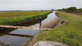
Eight students explored a range of topical water issues across coastal and environmental engineering and water resources—with all projects linked to improving understanding and minimising harmful impacts of climate change.

WRL Director Professor Denis O’Carroll said that it was a fantastic achievement for WRL to mentor eight PhD students to completion in one year.

“These students have made very important contributions to the impact of climate change on water quality and coastal vulnerability and infrastructure that can help mitigate against these impacts,” said Prof O’Carroll.

“Their work will undoubtedly have important impact across a range of disciplines in the decades to come.”

Reflecting on their PhDs, the students themselves were proud of their achievements and grateful for the support provided by staff, supervisors and peers.

Shuang Liu said, “I really enjoyed undertaking my PhD studies in UNSW. My supervisors, A/Prof. Fiona Johnson, A/Prof. William Glamore, and Dr. Bojan Tamburic are excellent mentors and very supportive. I feel comfortable and grateful for being part of a great and friendly environment; the staff, researchers and students here provide me with a lot of emotional, social and academic support. I had many sweet and memorable moments in the past four years.”

Jamie Ruprecht said, “It is a profound learning experience and life-long personal accomplishment to complete a PhD.  Throughout my studies at UNSW, I navigated through the wins, frustrations, and uncertainties of bringing together the fields of science and engineering, while I adjusted to the world of academia after several successful years working in industry at UNSW WRL. This was made possible by the guidance and support of my outstanding supervisory team and network of professional colleagues, family and friends.”

Ahmed Nashwan Abdul Matheen said, “I really enjoyed my time at WRL. The people I’ve met over the four years and the things I’ve learnt from them will stay with me forever. I couldn’t have asked for a better place and a better group to work with.”

Congratulations to the eight PhD students, whose research is summarised below.


Danial Khojasteh
Danial Khojasteh
Estuarine hydrodynamics under sea level rise

Danial’s PhD presents a systematic hydrodynamic understanding of different estuaries and tidal rivers in present-day and future conditions to detail the influence of sea-level rise (SLR) on tidal dynamics, establish a framework for assessing SLR effects on estuaries worldwide, and guide decision-makers in establishing holistic, evidence-based management plans for these valuable environments. The numerical approach and learnings presented in his PhD thesis could be used to identify estuaries that are most vulnerable to SLR-induced tidal variations (e.g., changes in high tide flooding, drainage efficiency, sediment transport, tidal energy) and to predict cumulative SLR impacts on estuaries at a global scale. 

Raimundo Ibaceta Vega
Understanding and predicting seasonal to interannual shoreline variability

Sandy beaches play a compelling role in our society, providing economic development and allowing for human settlement.  In a changing climate, expected future modifications in waves and storm activity, together with sea level rise, can lead to increased coastal erosion and flooding, threatening the fate of sandy beaches. To improve our predictive capabilities of sandy shoreline evolution to these changes in climate forcing, Raimundo’s researched focused on revealing how sandy beaches naturally evolve and adjust from seasonal to interannual (several years to decades) time scales. Through data analyses (machine learning, clustering), data assimilation and numerical modelling approaches, his research provided new insights on the physical drivers of shoreline change from single beaches to regional scales, as well as new ways to improve future shoreline change predictions in a changing climate.

Christopher Leaman
Christopher Leaman
Regional-Scale Forecasting for Coastal Storm Hazard Early Warning Systems

Sandy beach and dune systems often provide coastal communities with the first line of defence from the impacts of extreme storm events. However, predicting both the nature and severity of these hazards is challenging, especially at the regional-scale (100-1000s kms). Christopher’s thesis first introduced a new conceptual framework for classifying storm hazards, before a simple decision tree approach to forecasting beach erosion was explored. Finally, recent advances in machine learning were leveraged and a gradient boosted random forest ensemble was trained to provide probabilistic forecasts of beach erosion impacts. It is anticipated the findings of this thesis can inform the implementation of future coastal storm impact EWSs around the world.

Ahmed Nashwan Abdul Matheen
An Early Warning System modelling framework for 'hot-spot' erosion forecasting along wave-dominated sandy coastlines

40% of the world's populations live within 100 kilometres of the coast. Consequently, these coastal areas are typically highly urbanised and therefore more vulnerable to the impacts of hazards such as extreme coastal storms. During his PhD, Nash developed a framework for a coastal hazard early warning system that can provide timely and effective information on potential erosion that can occur along coastlines, several days ahead of the storm event. When implemented, this system will predict with a certain degree of certainty, the location and magnitude of the expected erosion so that emergency response teams can take action to reduce the risk to those that are exposed to the hazard.

Shuang Liu
Shuang Liu
Understanding algal blooms in shallow waterbodies

Small, constructed waterbodies are designed to attenuate floods and enhance water quality. Despite a range of guidelines that inform the design of these waterbodies, many still experience harmful algal blooms (HABs). It is vital to improve our understanding of how small waterbodies respond to HABs, considering the increasing number of small waterbodies being built globally and increasing HAB risk with climate change. This thesis provided design recommendations for small, constructed waterbodies to limit HABs, and tested the utility of remote sensing detection methods for HABs and water quality in these waterbodies.

Jamie Ruprecht
Jamie Ruprecht
Integrating microbial and nutrient dynamics to improve waterway management

Eutrophication is caused by high concentrations of nutrients, namely phosphorus and nitrogen, entering waterways.  Wastewater pollution contributes to these nutrient loads and accounts for approximately 15% of all river inflows worldwide.  Impacts can range from the restricted use of local waterways in-line with community values, including fishing and swimming, to outbreaks of algal blooms that inhibit aquatic productivity (e.g., fish kills), and human health issues associated with pathogens.  Jamie’s PhD integrated best practice numerical modelling methods and microbial science to determine the role of microbes in responding to, and processing nutrients from, treated effluent.  The outcomes will assist with (i) developing monitoring programs that better our understanding of waterway functioning, (ii) accurately representing biophysical processes throughout an entire waterway, and (iii) developing integrated catchment management plans. 

Kilian Vos
Kilian Vos
Satellite remote sensing along sandy coastlines: shoreline monitoring, beach slopes and multi-decadal climate variability

Sandy coastlines are dynamic landscapes that constantly evolve as they respond to environmental conditions like waves, coastal storms, and tides. Along many urbanised coastlines, these changes can have disastrous consequences on beachfront infrastructure and property. A better understanding of how shorelines advance and retreat is the key to a successful management of our coastlines. Kilian’s  PhD research provides new tools to monitor coastlines from space, leveraging the 35-year archive of publicly available satellite imagery. These tools were all made open-source and can be used by coastal managers and engineers worldwide to gain insights into coastal change patterns and trends at their local beach. In my thesis, these novel tools are used to investigate the impact of El Nino Southern Oscillation on beach changes across the Pacific, highlighting the vulnerability of the East coast of Australia during La Nina phases.

Rui Li
Application of LiDAR Technology in Air-water Flows in Hydraulic Structures Engineering