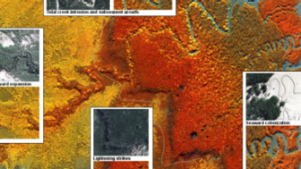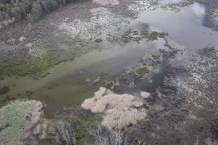
In the north of Australia, both a seaward and landward movement of mangroves has been observed from time-series of Landsat sensor data and aerial photography, with this attributed in part to a combination of sea level rise and increased sedimentation associated with high intensity rainfall events. These mangroves may therefore be barometers of climate change, particularly as these have remained largely undisturbed from human disturbance. The Centre for Ecosystem Science is focusing on understanding and quantifying the causes and consequences of such changes, with particular focus on Kakadu National Park and the Gulf of Carpentaria. The former study is making use of baseline maps of mangrove extent and height (Lucas et al., 2002; Mitchell et al., 2006) generated for all mangroves in Kakadu National Park using stereo aerial photography acquired in 1991, Compact Airborne Spectrographic Imager (CASI) data from 2000 and a combination of dense time-series of Landsat sensor data as well as both airborne and spaceborne Synthetic Aperture Radar (SAR) data. The project is also contributing to the Japanese Space Exploration Agency's (JAXA) Kyoto and Carbon (K&C) Initiative.
References
Mitchell, A.L., Lucas, R.M., Donnelly, B.E., Pfizner, K., Milne, A.K and Finlayson, M. (2006). A new map of mangroves for Kakadu National Park, Northern Australia, based on stereo aerial photography. Wetlands Ecology and Management, 17, 446-467.
Lucas R.M., Mitchell, A., Donnelly, B., Milne, A.K., Ellison, J. and Finlaysson, M. (2002). Use of Stereo Aerial Photography for Assessing Changes in the Extent and Height of Mangrove Canopies in Tropical Australia. Wetlands Ecology and Management, 10, 161-175.


