ARC Linkage Project LP0774833
This project is a three year research project headed by Prof. Richard Kingsford and involving eight other chief investigators from three universities and two government departments. The project has been primarily driven by the UNSW and the Blue Mountains World Heritage Institute and is managed by Dr Daniel Ramp.
Investigators include Prof. Richard Kingsford, Dr Daniel Ramp, Dr Shawn Laffan, A/Prof. John Merson, Prof. Ross Bradstock, A/Prof. Rob Mulley, Dr Tony Auld, Dr Rosalie Chapple.
Partners include the NSW Department of Environment, Climate Change and Water, the Blue Mountains City Council, the Hawkesbury-Nepean Catchment Management Authority, the NSW Department of Primary Industries and the Blue Mountains World Heritage Institute.
Summary
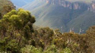
Australia is a bio-diverse country with many threatened species. Our reserve system is one important way of protecting biodiversity, and the Blue Mountains are a standout reserve. The Greater Blue Mountains World Heritage Area (GBMWHA) is the largest continuously forested area in NSW and also contains its largest declared wilderness area. Reserve protection, unfortunately, is no guarantee of in situ conservation of biodiversity. Some threats extend into and beyond reserve boundaries. In a climate change world, we need to adapt to the changes that will occur and most effectively manage to protect the biodiversity of the WHA.
The research undertaken through the ARC Linkage ‘Managing Ecosystem Change’ project aimed to build the knowledge base to inform management of drivers of ecosystem change (frequent fires, climate change, and invasive species) in the GBMWHA. Spatial impacts of these drivers of change were identified, and their likely impact on biodiversity conservation. The research aimed to inform management at different spatial scales and to assist conservation policy and management options through analysis of trends and development of spatially-explicit models within an adaptive environmental management framework.
Objectives
1. Development of an adaptive environmental management framework
The overriding aim of this project is to facilitate links between science and policy to better manage World Heritage values in the GBMWHA, particularly in light of unprecedented drivers of change. There is great need to utilise information for capacity building and enabling the development of a spatially-explicit decision framework to ensure the sustainable conservation of the GBMWHA.
2. Past and current ecosystem condition
The past and current spatial extent and condition of ecosystems within the GBWMA will be quantified using two methods: remote sensing and GIS, and biodiversity and natural resource surveys.
3. Reserve effectiveness
Schemes for evaluating the location and design of reserve systems rely upon methods for systematically selecting land units, taking into account reserve size, the number of separate land units within the system and their proximity, configuration, connectivity and shape. This is important because cost-effective options for conservation must be derived from a decision-making process that is quantitative and accountable. This component will explore a variety of approaches to contrast their effectiveness in the decision-making process in order to provide decision makers with the best available information.
4. Responses to drivers
In this project, we’ll focus on rapid climate change, altered fire regimes, invasive species, urban expansion and road development as drivers of change within the GBMWHA. We will spatially quantify the current and future impact of drivers on biodiversity within the GBMWHA.
5. Modelling ecosystem condition and drivers
We’ll develop spatially-explicit population models of surrogate species to answer questions relating to reserve design, predicted impacts of drivers and the efficacy of different management strategies. Using this approach, we will be able to quantify: the response of surrogate species to altered conditions; the efficacy of management decisions in reducing the impacts of altered conditions; and the sensitivity of ecosystem condition to individual drivers and future scenarios of change.


