

Date: Thursday, October 11, 2018
Project: Eastern Australian Waterbird Survey
Observers: Richard Kingsford
We left Tibooburra early in gloriously crisp and sunny conditions and finished the day dodging storms and bouncing around in howling winds on the east coast. Even though it wasn’t going to be that hot, we decided to get away early. Just as well we did because we ended up with a five hour stint in the plane, after refuelling at Bourke. It meant that the plane could get in for an early service on Friday and still get out on the Monday for the next leg.
Our survey band stretched from north of Broken Hill through to Armidale in the east. We had perfect flying conditions to begin with. Not much to see with nothing really with water in it until we reached the Darling. Even many of the dams with water had little. There were some grim sights of dead and dying livestock and kangaroos around dry dams. The always wonderful Paroo River overflow lakes were dry, with no water anywhere. Only one small blackbox swamp had obviously got a bit more rain than usual and had water. Even though small, it was ‘brimming full’ with waterbirds.
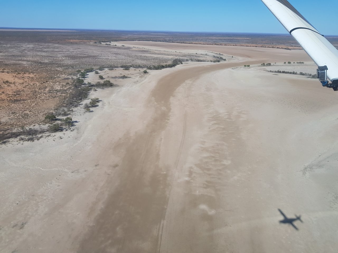
Mullawooka Basin, one of the dry Paroo River overflow lakes
UNSW
We then reached the Darling River; it had a green hue, generally indicative of blue-green algae, which can be damaging to fish and also livestock. I was surprised at how low the river was, reduced to a series of large pools in many places. There were probably the usual number and diversity of species that we see on the river, mostly including pelicans, herons and cormorants.
After refuelling in Bourke, we had more of the same heading east – farm dams at various levels of drying. Those with water generally had a couple of waterbirds. We finally reached the Macquarie Marshes which was the first major area we had seen with a reasonable amount of flooding. Even the Diamantina River did not have as much water. It showed the importance of the environmental flow currently flowing through the Marshes. There is some misapprehension that wetlands don’t need water during drought and we should be irrigating crops instead. This is wrong on many counts. Importantly these environmental flows provide much needed habitat for waterbirds which need water to live. Of course there are lots of other animals, plants and other organisms that depend on the water as well and farmers also benefit. Surprisingly, we didn’t see that many waterbirds in the most northern part of the marshes where the environmental flow had reached. Potentially they could have been further south or the numbers more generally have declined much more than I hoped or it would take a bit more time for the wetland to respond.
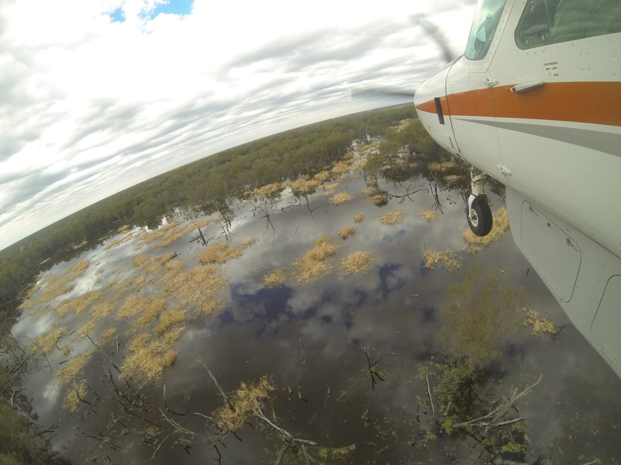
The Macquarie Marshes with an environmental flow
UNSW
And then further east, we just saw more dried up or almost empty farm dams and wetlands. The weather became more unsettled as we went, passing just south of a thunderstorm at Narrabri. The next surprise was the Namoi River in terms of waterbirds. In the 30 odd years I have been surveying this river, it has hardly had any waterbirds. This year was quite different. There were hundreds of wood ducks, teal and black duck. This probably reflected the sparse wetland habitat around but also how low the river was. Because it was shallow, there were lots of areas for waterbirds to feed. From there we bounced on to Split Rock Dam, one of the major dams on the Namoi. Again it was at low levels, only 13.4% full and so the ‘arm’ that we normally fly up was very narrow.
As we headed towards Armidale, the weather started to close in. It got bumpier with the 40 knot southerly and started to rain. We finished off on a couple of dams around Armidale, as part of our usual route and then headed south to survey some dams and the Hunter River on the next most southerly survey band. We got back to Sydney late. As always a memorable, exhausting but also wonderful way to see the rivers and wetlands of eastern Australia, over the last ten days or so. Our data this year will add another annual point to our understanding of waterbird numbers and how they are a sensitive barometer to the health of our rivers, tracking natural variation but also our impacts. Next week another team does the two survey bands to the south, out to Menindee Lakes and then down near Balranald on the Lowbidgee floodplain.