Day 4, Rockhampton to Birdsville


Date: Friday October 7th 2022
Project: Eastern Australian Waterbird Survey
Observers: Richard Kingsford & Paul Wainwright
Pilot: Tim Dugan
We headed out of Rockhampton with some concern about the weather. The front was heading our way. It was just a question as to when we would meet it and how strong it would be. Thankfully we were a fair way north and so were hopeful that up here it wouldn’t have the same damaging strength as further south.
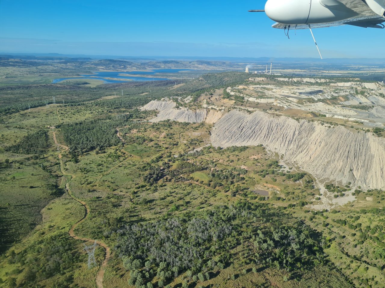
First wetland to survey was the cooling dam for the coal-fired power station, with its coal at Callide.
These large dams are deep and so the waterbirds are few and we only surveyed a few cormorants and pelicans.
From here, there were a few lagoons around Biloela and Moura, in between the coal mining.
These lagoons are usually deep and permanent and so do not make good waterbird habitat. Even a long lagoon such as this only had a few black duck.

Then over the coal mine at Moura
It was primarily dams along the way along here, before we started to survey the large rivers of the west.

Surveying one of the many dams out here. Most had a few waterbirds, usually black duck and wood duck but also grey teal.
We refuelled at Blackall on the Barcoo River. It was windy and looking ominous in the west, mainly to the south rather than directly west where we were going.
The Barcoo River was flowing reasonably strongly, a rare sight at this time of the year.
Barcoo River with a good flow.
One of the wonderful parts of this survey is crossing these big western rivers every two hundred kilometres (the distance between our survey bands), from north to south. We had seen the Thomson River the day before, near Longreach. Down here it was flowing in many of its channels before joining Cooper Creek.
Survey of Thomson River

Thomson River
Then it was on to the mighty Diamantina River. Here it was much wider across its floodplain, compared to where we crossed it near Winton yesterday. The flow was also reasonably strong in its main channels.
Diamantina River in flow.

One of the many branching creeks running into the Diamantina River.
It was about here we met the storms. There were a range of storm cells right across in front of us. Luckily, we only briefly went through one of the relatively weaker storm cells. Thankfully it didn’t last long before we were on our way again. The real blessing was the cool temperature. It was great for flying although there was still a strong wind making it a bit bumpy.

Storm cells ranged across in front of us
We then surveyed the Lake Machattie which was barely thirty percent full and the two other lakes, Koolivoo and Mipia.
Surveying Lake Koolivoo
If you are into waterbirds as we are, and even if you aren’t, these lakes are spectacular for their diversity and numbers of waterbirds. There were thousands of ducks and pelicans on the shallow Lake Koolivoo, mostly grey teal, pink-eared ducks and red-necked avocets but also a range of other species. Lake Mipia had fewer birds and Lake Machattie even less.

Eyre Creek flood runners into Lakes Koolivoo and Mipia.

Lake Koolivoo

Inlet from Eyre Creek to the two lakes, Lake Mipia and Lake Koolivoo.
Then it was to the west to see if there was any water in the most westerly lakes in this survey band. This is on the edge of the Simpson Desert. They were all dry apart from some water in the Mulligan River and other drying waterholes.

Out here there were just dry lakes in between the dunes.
Surveying one of the drying waterholes on Eyre Creek.
There were very few waterbirds, usually no more than about thirty. With so much flooding everywhere, most waterbirds had moved into the newly flooded areas.
We landed for the night at Birdsville.

Our plane at sunset.