Day 5, Birdsville to Maroochydore


Date: Saturday October 8th 2022
Project: Eastern Australian Waterbird Survey
Observers: Richard Kingsford & Paul Wainwright
Pilot: Tim Dugan
Once again the weather forecast was grim as the massive low pressure system made its way through a large part of the inland. We knew we needed to get away early to stay in front of the front. It was soon pretty obvious that we had made the right choice.
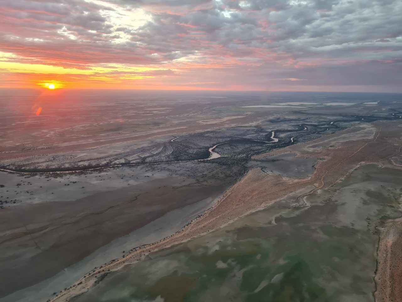
Sunrise with the storm clouds gathering.

As we looked west, there was even a rainbow forming.
Our first survey was on Andrewilla Waterhole on the Diamantina.
This waterhole on the Diamantina had a spectacular backdrop of the sun rising and the storm clouds coming in from the west. Even early, we experienced a few drops of rain. This waterhole never has more than a few pelicans, the odd cormorant and large egret and today was no different.
Some of the shallow lakes had flooded with the last flood on the Diamantina and were drying back showing the colours of the flowers from the plants which had germinated with the flood. There were very few waterbirds, just a few pink-eared ducks and some hardhead on these large areas.
Surveying one of the drying lakes flooded by the Diamantina River.
We then headed east towards Cooper Creek and its floodplains. It was clear that there had been a reasonable flood. You could see the green line from the growth of plants that germinated on the last flood on Lake Yamma Yamma, even though the lake didn’t fill and was now dry. Where the water had been was green, compared to areas not flooded.
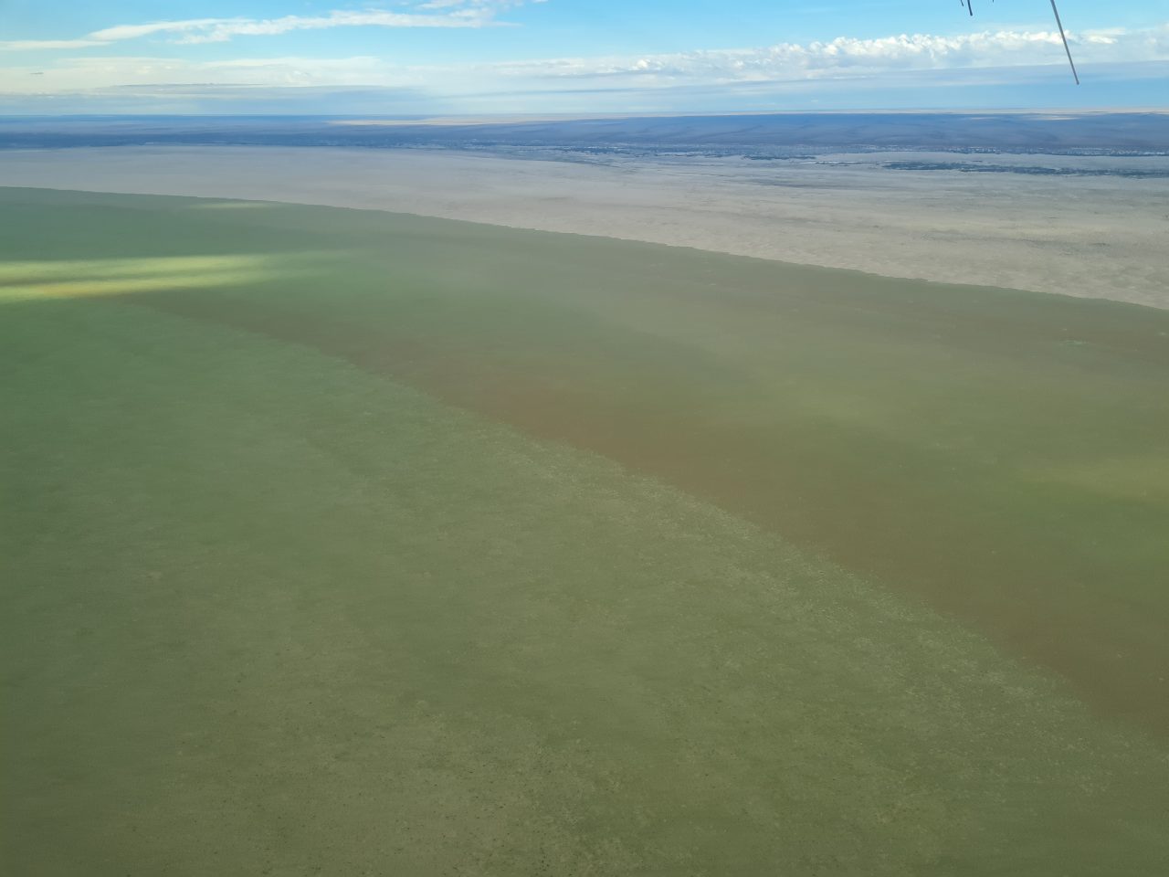
Lake Yamma Yamma’s flooded edge.
We then surveyed the Cooper’s waterholes, going north and south. They had a few waterbirds but no more than about a hundred in the five waterholes we surveyed. Along its length, this is still a large number of waterbirds on these largely permanent wetlands. They were mostly pelicans, cormorants, black duck and grey teal.
Surveying Cooper Creek’s waterholes.
You could see where the last flood had been, creating ‘crazy paving’ green across the landscape where the plants had grown with the flood, compared to the dark grey where they hadn’t.

Areas recently flooded by the Cooper but now dried back.
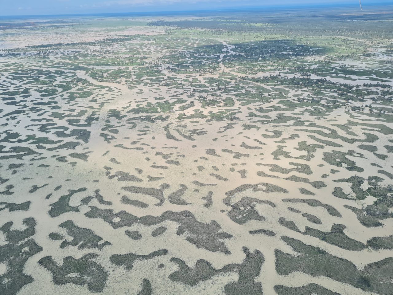
It wasn’t long after this that we saw the results of the rain over the past couple of days with massive, flooded areas just west of Cooper Creek.
Local flooding in places not seen before in our 40 years of surveying.

One of creeks had enough local rainfall to start flowing onto the Cooper Creek floodplain.
Extensive local flooding from the last two days of rain.
There was water everywhere but very few waterbirds.
Extensive low-lying areas were under water near Quilpie.

Quite a few of the roads were cut.
The Bulloo River was swollen in flood as it flowed past Quilpie with many of the tributary creeks also in flood.
The Bulloo River in flood.
As we headed to Charleville, we crossed the Paroo River and its tributaries. All were in flood. This would probably be the first time in the forty years of this survey that we have seen such widespread flooding here in the middle of the survey.
We refuelled in Charleville and then headed east.
Soon after, we come across areas of extensive and seemingly quite recent land clearing of the mulga.
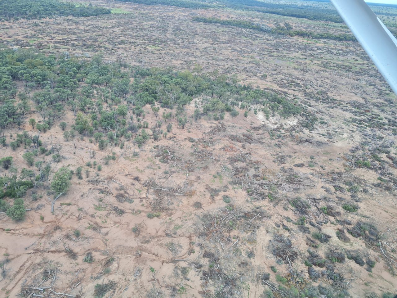
Recent land clearing east of Charleville.
From here it was mainly surveying farm dams all the way to the coast, with the odd large water supply dam. They had their usual numbers of a few waterbirds.
The weir near the town of Mitchell.
Most of the dams were full of water, reflecting the widespread rainfall across eastern Australia over the last few years.
We reached Maroochydore in the late afternoon.