Day 6, Maroochydore to Thargomindah


Date: Sunday October 9th 2022
Project: Eastern Australian Waterbird Survey
Observers: Richard Kingsford & Paul Wainwright
Pilot: Tim Dugan
The rain finally caught up with us or we caught up with the rain. It poured overnight in Maroochydore and we woke to a leaden sky and rain. A quick check of the radar and it looked like we were going to be ok to head west, 200 kilometres to the south. However when we got to Warwick the cloud was low of the ranges and we had to fly north to find a gap where the hills weren’t so high.
Our survey of Band 6 started just east of Goondiwindi on Coolmunda Dam which is on a tributary of the Macintyre River on what is known as the Border Rivers.
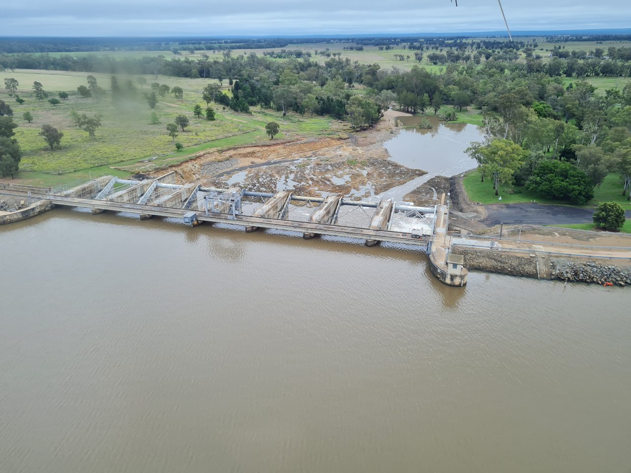
Water flowing down the spillway of Coolmunda Dam.
Coolmunda dam is always a reasonably good waterbird habitat and is important in dry years, particularly as it can operate as a refuge, when most other natural and productive waters are dry.
As expected, there weren’t many waterbirds on the dam today. There were a few black duck, grey teal and black swans and whilst there were were more than a hundred cormorants and small flocks of pelicans, overall numbers and diversity was down on drier years.
Surveying Coolmunda Dam.
Then the least favourite part of the whole aerial survey for me. We fly back and forth, north to south, over what seems endless off-river storages, or large dams, which hold water on cotton farms for irrigation.

Off-river water storage for cotton irrigation.
They extend more than 200 kilometres, from just east of Goondiwindi all the way to Dirranbandi and Cubbie Station.
Surveying an off-river storage near the Macintyre River.
These large storages either only have a couple of fish-eating waterbirds, cormorants, pelicans or darters, or more often no birds. It is quite easy to survey them apart from the ‘zig-zag flying’ between them which is very tiring. It is only when they are drying back and the water is shallow that they have any useful habitat for waterbirds. With all the wet weather and run-off, most of them were full.
Flows are diverted from the Macintyre, Weir, Moonie and Culgoa Rivers along the way.

Cotton bales at the Goondiwindi Gin, alongside the Macintyre River.
There were a few small natural wetlands remaining in this landscape. And they really only look as if they are good habitat in wet years, when there is enough flow to get to parts of the floodplain that are cut off by too much water extraction or structures.
One of the reasonable sized waterholes is Boobera Lagoon, a permanent wetland on the Macintyre River.
Surveying Boobera Lagoon.
It is never particularly good waterbird habitat because it is permanently full. Today it still had a lot more than an equivalent sized storage with some wood ducks, black ducks and a couple of spoonbills and pelicans.
The area is very wet from recent rains with water lying across many of the cropping areas.
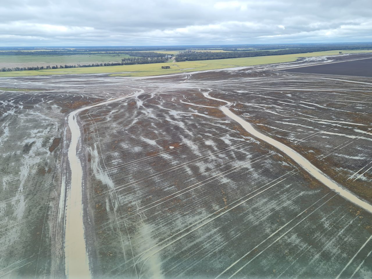
Local flooding on cropland.
On the Moonie River, near the town of Thallon, there is an extensive wetland but much of it has been cleared and it likely does not get flooded as often or as extensively as it did in the past because of the water resource development. Today it had extensive but not full flooding and even though there is widespread water, there were about a hundred waterbirds of a reasonable diversity. Black duck, glossy ibis, pelicans and cormorants were among the most numerous.
Surveying the Thallon wetlands.
We had our break to refuel and lunch at Lightening Ridge, once we had surveyed most of the large dams for irrigating cotton. A good time for a break as it is always exhausting going through this section.

Lightening Ridge, opal mining town.
We then headed out to the wet west. This was where the rain had really delivered in the past few days.
The first reasonable river system was Nebine Creek which I have never seen with as much water. As with all full and flowing rivers and creeks, it was not great waterbird habitat.

Nebine Creek in flood.
Then it was on across the Warrego River and the major branch of Cuttaburra Creek, with both running a reasonable flow.

Warrego River.

Cuttaburra Creek.
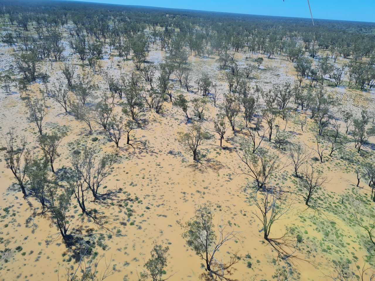
South of Cunnamulla, there are hundreds of small claypans, blackbox swamps and canegrass swamps which were all full from the recent flooding in the last couple of days.

Small claypan with its own catchment filled from local rain.
Surveying one of the reasonably large canegrass swamps filled by local rainfall.
Many of these had one or two waterbirds, often Pacific herons which are probably feeding on tadpole shrimps which hatch quickly once the systems are flooded.
Then we headed west towards the Paroo River, which also had a good flood.
Paroo River in flood.
Finally we ended up in Thargomindah for the night, on the banks of the Bulloo River with a good flow of water.

River red gum on the Bulloo River at Thargomindah.