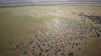
Date: Tuesday, October 11, 2016
Project: Eastern Australian Waterbird Survey
Observer: Richard Kingsford
A welcome cold morning at 150 C. Cool is ideal when we are surveying the outback. On hot days, the plane bounces as it hits pockets of rising hot air. We soon find out that conditions aren’t so perfect with an 18 knot head wind which also bounces us around and slows the plane. Down low, the wind buffets as it reflects the contours of the land.
Once again, we soon see the results of the rain and floods with one of the big farm dams having its wall blown by the power of the water.
The gaping hole in a large farm dam shows the strength of the water on a dammed creek
Just east of Charleville, we survey two swamps that fill from local rainfall. The shallow water and large area is ideal for breeding birds with black swans sitting on nests and a brolga.
Shallow water swamp, just west of Charleville, nearly always dry but not today
This morning’s leg, heading east along Band 7, takes us over Mitchell, Roma and on to refuel at Kingaroy. There are a few lagoons on the rivers but mostly we are surveying small farm dams along this band. About every one in three has a couple of waterbirds, mostly black duck, the odd pelican, a cormorant and wood duck.
Surveying dams west of Mitchell
As we get close to Kingaroy, there are big dams to survey including Bjelke-Petersen Dam which had a few hundred pelicans and cormorants. It was surprisingly low, given how full the farm dams have been all along this survey band.
Surveying waterbirds on Bjelke-Petersen Dam
Fuel and lunch at Kingaroy before we head south to pick up Band 6. Our first overnight stay at Maroochydore on day 1 of the survey and at the end of this survey band seems a long time ago. This afternoon is one long slog. First we survey Coolmunda Dam on the Macintyre River system, just near Inglewood. We used a new camera to get vertical vision with GPS coordinates.
Surveying Coolmunda Dam
Then we head west where the Border Rivers floodplain stretches, past Goondiwindi. This is irrigated cotton country. Laser levelled irrigation areas are interspersed with large off river storages which hold irrigation water for summer. There are literally hundreds all the way past the Macintyre, Weir, Moonie River, Balonne and and Culgoa River where Cubbie Station dwarfs the other small water storages. Cumulatively, these storages make a significant ecological impact on the floodplains but they also mean that a lot of this floodwater doesn’t make it downstream to other parts of the river, particularly the Lower Darling River.
Storages used to hold water for irrigated cotton seldom have many waterbirds
These off-river storages just have the odd pelican or comorant. Their water is usually too deep for the high biodiversity of waterbirds seen on natural wetlands. The dams do not build up the rich food web of a natural wetland.
We eventually make it through the maze of off-river storages, emerging out of the irrigation areas and on to the western flowing rivers of the Murray-Darling Basin. We finish up where we started this morning, back on the Warrego River, at the downstream town of Cunnamulla.
The floodplain of the Warrego River, like a lot of the inland is unusually green
