Date: Wednesday, October 7, 2020
Project: Eastern Australian Waterbird Survey
Observers: Richard Kingsford UNSW, Paul Wainwright DEWHA
Pilot: James Barkell NSW National Parks & Wildlife Service DPIE
Up at daybreak to fly over the Darling River and head north to pick up our survey band and then head west to the Warrego, Paroo and Bulloo Rivers. In really wet years, we can also continue on this survey band to Strzelecki Creek and Cooper Creek, even out to Lake Eyre. Not this year. There need to be a series of good floods for that to happen which isn’t very often. Last time the Cooper got into Lake Eyre was in 2010-2011. Perhaps this La Nina year will be time again.
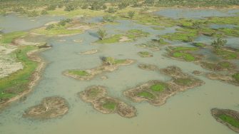
The country looks spectacularly green out here for the outback. Lovely to see. Southwest of Cunnamulla and on the Paroo River floodplain, it was obvious to see the effects on the small with the flooding of claypans, swamps and cane grass swamps which dot the landscape. It is challenging surveying because they are small and sometimes everywhere and so a lot of back and forth. But great to see that some of them had tens and twenties of different species of waterbirds, including grey teal, pink-eared duck and Pacific herons.
The next river west was the spectacular Bulloo River. I have always loved this river which meanders along, showing its red rocks, west across the dry landscape. It disgorges its river flows into the wonderful Bulloo overflow lakes in Queensland which then tip into Caryapundy Swamp, a massive floodplain area in New South Wales called the Bulloo River overflow and now a recently announced national park – Narriearra. A key strategic opportunity awaits to make this a Ramsar site and afford it more protection of its essential water supply from the Bulloo River. Today as we surveyed – it started to rain (splodges on the video).
We refuelled at Tibooburra before heading south and east along our Band 5 which starts at Starvation Lake on the NSW/ South Australian border. It would need a lot of rain to fill this lake which hasn’t happened in all the time we have been surveying, since 1986. We headed east, just north of the pub at Packsaddle. There are 30-50 small swamps and lakes between here and White Cliffs which fill from local rain – and this year there has been rain. Not enough to fill them all but they kept us busy. Each has a unique ecosystem, varying in size, salinity and vegetation. These are often reflected in the waterbird communities. The clear lakes with their carpet of aquatic vegetation are great for swans, coot and hardead while the salt lakes often have the small wading birds, such stilts.
Once we had meandered our way through the twenty odd small wetlands which had water, we headed for the wonderful Paroo overflow lakes. These magnificent lakes had water in them for the first time in a few years, courtesy of this free-flowing river allowed to fill the great wetlands and swamps that make up the Paroo overflow and Cuttaburra channels. We weren’t disappointed. The lakes were almost full. It looked to me like Peery Lake may have got most of its filling from local runoff because the bottom end wasn’t that flooded. It sometimes does this. Yantabangee had lots of waterbirds and a high diversity. It was great to see large flocks of pink-eared ducks and small flocks of freckled ducks. There were also a few ducks breeding. Glossy ibis were also around but not breeding as they do in some years on Mullawoolka Basin.
Further to the east were the Cuttaburra Channels. They take the waters of the Warrego and Paroo Rivers, making up an intricate network of amazing wetlands. It was getting late when we got to them, after the Paroo overflow lakes, and the late afternoon sun showed them up in all their glory. There were thousands of waterbirds on these wetlands. Spectacular stuff and great to see after so many dry years. Even though it had been a long survey day, we were all up for it. Very privileged to see such a magnificent sight. Waterbirds in all directions. Lots of breeding swans.
We finished the day flying over a dry Darling River floodplain and onto the river. It was good to see the green tinges where some water had broken over the banks onto the floodplain. But I thought I would see more water flowing down the river. It already looked pretty shallow and breaking up into pools. The flood that came down the river wasn’t enough to give it a real kick start. Not enough water got down to this part of the river despite the promise from its tributaries. Diversions of flows continue to impact on the ecology of this river and the people who depend on it down the river in places like Wilcannia and Menindee. It is a sad river compared to the Paroo. Hopefully future generations will at least have the Paroo to see what a spectacular free-flowing river can do.
Blog by Richard Kingsford
